A Contractor’s
Perspective for the
Use of Mobile LiDAR
There are more benefits than you thought
By Suliman Gargoum, Ph.D., Chief Research Officer, and Lloyd Karsten, MSc., E.I.T., LiDAR & GIS Research Engineer, Nektar3D
In recent years, contractors have benefited substantially
from advancements in technology to replace traditional,
time-consuming survey methods. This has included the
introduction of robotic total stations, military grade GPS systems,
high-resolution imagery and light detection and ranging
(LiDAR) scanning.
LiDAR data collection involves a laser scanning system
reflecting light rays off surrounding objects to create a
highly detailed representation of the surrounding environment.
Although dependent on the quality of the LiDAR
scanning system and the data collection environment,
mobile LiDAR systems are able to achieve millimeter-level
relative and absolute accuracies.
With recent software advancements, the use of LiDAR
data has become much more realistic across a wide range
of construction projects. To understand how a contractor
might benefit from LiDAR data, this article will focus
on three critical project details: quantity estimation, job-site
review and adjustment and asset management.
Quantity estimation
Quantity estimation is a significant component to any
construction operation, and in the event of unit price contracts,
it is the defining detail which pays out the work
completed. Instead of requiring survey crews to work
alongside construction or having to wait for the owner’s
surveyors between construction stages, LiDAR can be
used to quickly survey the entirety of a construction area
and provide accurate estimates of pay item quantities.
Common pay items include distance, area and volume
measurements, all of which are simplified when conducted
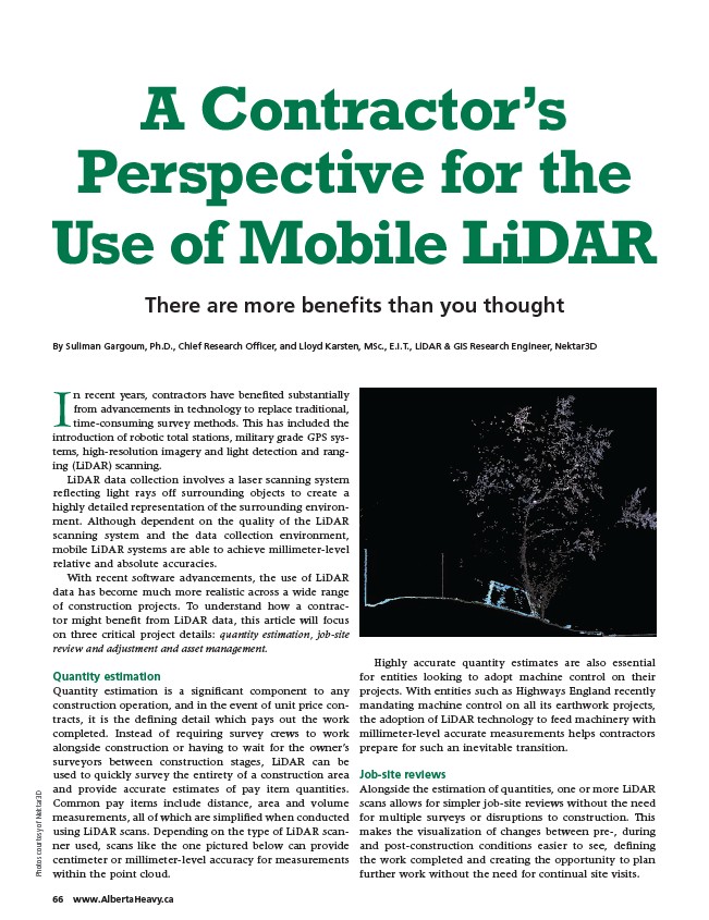
using LiDAR scans. Depending on the type of LiDAR scanner
Nektar3D
of courtesy used, scans like the one pictured below can provide
Photos centimeter or millimeter-level accuracy for measurements
within the point cloud. Highly accurate quantity estimates are also essential
for entities looking to adopt machine control on their
projects. With entities such as Highways England recently
mandating machine control on all its earthwork projects,
the adoption of LiDAR technology to feed machinery with
millimeter-level accurate measurements helps contractors
prepare for such an inevitable transition.
Job-site reviews
Alongside the estimation of quantities, one or more LiDAR
scans allows for simpler job-site reviews without the need
for multiple surveys or disruptions to construction. This
makes the visualization of changes between pre-, during
and post-construction conditions easier to see, defining
the work completed and creating the opportunity to plan
further work without the need for continual site visits.
66 www.AlbertaHeavy.ca
/www.AlbertaHeavy.ca